
Our readers keep the lights on and the weekend projects moving. As an Amazon Associate, I earn from qualifying purchases.
Specs are compiled from manufacturer listings and verified buyer reviews and can change over time — please confirm the key details on the product page before buying.
When your phone shows “No Service” and the trail splits three ways, a dedicated hiking GPS keeps you found with a satellite lock, long battery life, and a screen you can read in full sun — none of which your phone can promise once you leave the cell grid. For a budget pick, the Garmin eTrex SE stands out because it runs for up to 168 hours on two AA batteries, so you stay oriented on multi-day trips without hunting for an outlet.
I’m Rikta — the founder and writer behind FitlyFast. This guide is built by comparing the manufacturers’ published specifications and the patterns across verified customer reviews, so you get each pick’s real strengths and trade-offs instead of marketing spin.
I’ve broken down the top budget-friendly handheld navigators on the market so you can pick the right trail companion without overpaying for features you’ll never use on the cheap gps for hiking.
Our Picks at a Glance


How To Choose The Best Cheap GPS For Hiking
Hiking GPS units come in two types. Pure navigators show you a dot on a grid, while full map readers display trails, rivers, and elevation lines. Your choice depends on whether you stick to established paths or plan to venture off them.
Battery Life Is The Real Spec That Matters
A phone dies after a few hours of constant GPS use with the screen on. A dedicated handheld runs on AA batteries for days. If you plan all-day or multi-day trips, look for units that stretch their power over 20 hours or more — some models here push far beyond that with a special power-saving mode.
Maps vs. No Maps — Know The Difference
Just because a device says “GPS” doesn’t mean it shows you a detailed map. Some budget units only track your path and show waypoints on a blank grid. If you need to see actual trails, contour lines, and landmarks, you’ll want a unit with preloaded topo maps or enough memory to download them.
Quick Comparison
| Model | Best For | Battery Life | Display | Satellites | Amazon |
|---|---|---|---|---|---|
| Garmin eTrex SE★ Best Overall | Ultra-Long Treks | 168 hours | 2.2″ Monochrome | Multi-GNSS (GPS, GLONASS, Galileo, BeiDou, QZSS) | Amazon |
| NiesahYan A6Budget Champion | Budget Track Recording | 20 hours | 2.4″ Color | 4 Systems (GPS, Galileo, BeiDou, QZSS) | Amazon |
| Garmin eTrex 10 | Reliable Basics | 20 hours | 2.2″ Monochrome | GPS + GLONASS | Amazon |
| NiesahYan 3.2″ | USA Topo Maps On A Budget | 36 hours | 3.2″ Color | 4 Systems (GPS, Galileo, BeiDou, QZSS) | Amazon |
In‑Depth Reviews
1. Garmin eTrex SE GPS Handheld Navigator
The Garmin eTrex SE runs up to 168 hours on two AA batteries, outlasting every other budget unit here by a factor of eight.
The Garmin eTrex SE earns its spot because it keeps running when everything else shuts down. In standard mode, it delivers up to 168 hours of battery life on two AA batteries (not included) — a full week of daylight hiking on one set, and four times the 20 hours you get from the NiesahYan A6. If you disappear into the backcountry for days, this is the unit that still answers when you press the power button.
You get a solid satellite lock in steep valleys and under dense tree cover because it tracks across five satellite systems (GPS, GLONASS, Galileo, BeiDou, and QZSS) — a single-system unit would wander there. The 2.2″ display is transflective monochrome, meaning it uses ambient light to stay readable in direct sun; buyers report “how easy the screen is to see during the day.” Pair it with the Garmin Explore app on your phone for trip planning, smart notifications, and automatic geocache updates.
The main drawback is the button layout, which takes time to learn compared to older toggle-style eTrex models. Owners note the button layout is less intuitive than older eTrex models that had a toggle switch, so there’s a small learning curve before you’re confidently naming waypoints. It’s also a renewed unit, so condition on arrival can vary — and it holds half the display of the pricier NiesahYan unit at 2.2″ versus 3.2″. But for pure staying power on a budget, nothing else here comes close.
What wins people over
- 168-hour standard battery life is category-leading by a wide margin.
- Five-satellite support keeps a lock in tough terrain.
- IPX7 water resistance handles rain and splashes fine.
- Bluetooth pairs with the Garmin Explore app for planning.
The trade-offs
- Renewed condition means the unit is pre-owned; owners mention slow shipping on occasion.
- Button navigation takes getting used to versus older toggle-style eTrex models.
Reach for it if: you want the absolute longest battery life possible and don’t mind learning a slightly different button layout.
Think twice if: you prefer a color screen with detailed maps — this is a monochrome, map-light navigator.
2. NiesahYan A6 Handheld GPS for Hiking
The NiesahYan A6 offers a 2.4″ color LCD and four-satellite support for fast locks, though it records tracks without maps.
If you want a bigger view of where you are, the NiesahYan A6 answers with a bright 2.4″ color LCD — about 9% larger than the 2.2″ Garmin eTrex SE, which helps when you follow a track line across the screen. At 6.1″ long and just 0.9″ wide, it slips easily into a jacket pocket or hip belt. This is a track-and-waypoint navigator, not a map reader: it records your path before you hike so it can guide you back to your starting point if you lose your way.
Buyers are consistent about one thing: “Fast GPS lock after initial use; stable under tree cover.” That stability comes from four satellite systems (GPS, Galileo, BeiDou and QZSS) working together. The rechargeable battery gives up to 20 hours of continuous use — the same figure as the pricier Garmin eTrex 10 — and tops up with a standard USB-C cable, so you don’t need to carry spare AAs. A built-in barometric altimeter reads elevation changes, and the digital compass holds an accurate heading even when you’re standing still.
The main limitation is the lack of preloaded maps, so it won’t name roads or trails on screen. The device comes with no maps at all, so it won’t tell you the name of the interstate or the nearest main road — one disgruntled cyclist returned it for exactly that reason. Another buyer found accuracy wavers on steep, winding trails while staying “fine on hills/flat.” If you stick to known paths and use it to record and retrace your route, it’s a solid, simple tool.
What makes it easy to like
- Larger 2.4″ color display is readable in direct sunlight.
- USB-C charging is convenient for modern packs.
- Rugged case and buttons work well with gloves on.
- Fast satellite lock under tree cover after initial use.
Where it falls short
- No maps — it won’t name roads, trails, or landmarks on screen.
- Accuracy can struggle on steep, winding trails.
Best for: hikers who want a bright, large screen to record tracks and follow them back — no map-reading needed.
Look elsewhere if: you need to see named roads or topo features; this is a blank-grid tracker.
3. Garmin eTrex 10 Worldwide Handheld GPS Navigator
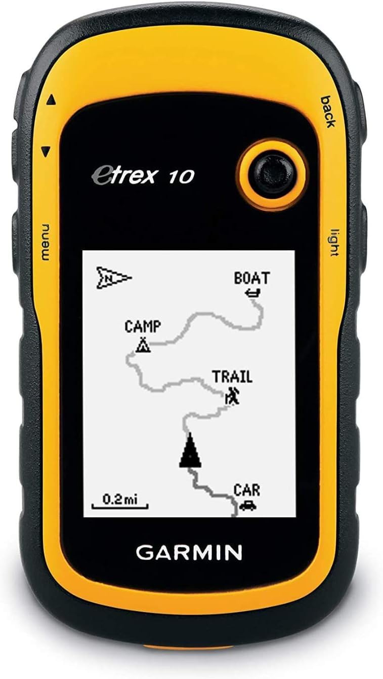
The Garmin eTrex 10 delivers 8-foot accuracy with GLONASS/WAAS, a rugged IPX7 build, and a 4.3-star rating from over 6,400 owners.
There’s a reason this is the most battle-tested unit here: it’s a crowd favorite with a 4.3-star average across more than 6,400 owners. The headline spec is accuracy — “Excellent accuracy (8ft) with GLONASS/WAAS, fast lock” is how a buyer put it, and 8 feet is tight enough to walk straight to a geocache hidden under a rock. That accuracy comes from a WAAS-enabled receiver with GLONASS support, which locks on faster and holds a position better than GPS alone.
The eTrex 10 is built for rough treatment. It’s waterproof to IPX7 standards, and one cyclist’s detailed test noted it “survived 10ft drops” while still tracking perfectly. The two AA batteries run it for up to 20 hours, and the monochrome screen draws so little power that a lithium AA set stretches that to over 50 hours in real-world use. The display is a 2.2″ monochrome LCD, which sounds dated until you’re in full sun — white-on-black text is actually easier to read in glare than a color screen.
You’ll trade maps for that reliability. This unit has no detailed maps and no SD card slot, so you’re navigating by waypoints, tracks, and a preloaded worldwide basemap. Customers note the manual is not great and waypoint entry via buttons takes practice — the advice is to set waypoints a bit before trail junctions to avoid confusion. The physical size is smaller than the NiesahYan A6 at 2.13″ long, so it disappears into a palm, but the glove-friendly buttons and trackback feature make it a favorite for returning to your car when lost.
Why thousands trust it
- 8ft accuracy with GLONASS/WAAS is the tightest lock in this lineup.
- IPX7 waterproofing and rugged build shrug off drops.
- 50+ hour real-world battery life on lithium AA cells.
- Paperless geocaching and sun/moon times built in.
The honest limits
- No SD slot and no detailed maps can be loaded.
- Screen scratches easily and instructions are weak.
Grab it for: geocaching, hunting, or any trip where pinpoint accuracy matters more than pretty maps.
skip it if: you want a color display with topographic maps — this is a precision tracker, not a map reader.
4. NiesahYan Handheld GPS with 3.2″ USA Topo Map

The NiesahYan 3.2″ pairs a preloaded USA Topo map with a 36-hour USB-C rechargeable battery, making it the largest-screen value pick.
If you want to actually see trails, contour lines, and terrain on a budget, this is the one. It’s the only unit here that pairs a preloaded USA Topo map with a generous 3.2″ sunlight-readable screen — nearly 50% larger than the 2.2″ displays on the Garmin SE and eTrex 10. That bigger view makes a real difference when you’re tracing a route across a valley. The 32 GB of internal memory gives you plenty of room to download additional maps for regions you visit often.
The battery story is strong too: up to 36 hours of life on a full charge, and it recharges through a standard USB-C cable. Location precision is rated within 6 ft, and multi-GNSS support (GPS, Galileo, BeiDou and QZSS) keeps you locked in open mountain terrain. A 3-axis compass and barometric altimeter round it out, giving you an accurate heading even when you’re stationary.
The physical buttons work fine with gloves and wet hands, and the anti-slip body feels secure in a grip. Buyers like the “save my spot” feature, and one wrote that it gave them “a great confidence” knowing their partner (an Adirondack 46er who climbs nearly every weekend) could be tracked. The honest caveats: it takes a couple of minutes to acquire satellites on a cold start, and one user found UTM coordinate and waypoint plotting flawed on an earlier unit. Performance is best in open terrain — urban areas give it trouble.
Why it stands out
- USA Topo maps preloaded — no map downloads needed for day one.
- 3.2″ screen is the largest display in this roundup.
- 36-hour USB-C rechargeable battery beats most rivals.
- 6 ft location precision with four satellite systems.
Things to know
- Cold-start satellite acquisition can take a few minutes.
- Connectivity is mixed in dense urban canyons.
Choose this if: you want big-screen topo maps and long battery without paying premium Garmin prices.
Be aware: map detail can be hard to see in bright sun and satellite lock slows down at startup.
Understanding the Specs
Battery Life (Hours)
This is the single most important number for a hiking GPS. It tells you how long the device runs on a full set of batteries or charge. A 20-hour unit covers a full day of continuous use, while a 168-hour unit can run for over a week of daylight tracking. Units that take AA batteries let you swap in spares from any convenience store; USB-C rechargeable units need a power bank on long trips.
Satellite Systems (GNSS)
GNSS is the umbrella term for all satellite navigation networks — GPS (American), GLONASS (Russian), Galileo (European), BeiDou (Chinese), and QZSS (Japanese). A unit that supports several systems at once locks a position faster and holds it better in valleys, forests, and steep country where a single system can lose signal. More satellites nearly always means steadier tracking.
FAQ
Will a budget hiking GPS work without cell service?
How long does a cheap GPS battery actually last on the trail?
Is a GPS with maps better than one without maps?
What is the difference between GPS and GLONASS?
Can I use a budget hiking GPS for geocaching?
How accurate is a cheap handheld GPS?
What does IPX7 waterproof rating mean?
Is a color screen better than a monochrome screen for hiking?
Final Thoughts: The Verdict
Across the board, the winner for the cheap gps for hiking is the Garmin eTrex SE because its 168-hour battery life and five-satellite support make it the most dependable tool in the budget tier. If you want big color topo maps and long runtime, grab the NiesahYan 3.2″. And for the proven accuracy geocachers and hunters swear by, the Garmin eTrex 10 is the one to reach for.
How We Picked
We do not accept paid placement. Every pick is matched to a real buyer and a real use-case; we do not hands-on test units.
Sources & Methodology
Specifications: manufacturer listings and product documentation. Review insights: verified customer reviews, as of August 2026. Pricing: not shown on this page (it changes often); check the current price via the retailer link.
As an Amazon Associate, FitlyFast earns from qualifying purchases. This does not affect which products we feature.